Colorado Rail Map
GDT > Features > Maps > Colorado Rail Map
Greater Denver Transit (GDT) presents a comprehensive map of Colorado and Utah’s rail infrastructure in collaboration with members of the Colorado Rail Passenger Association (ColoRail), the Utah Rail Passengers Association (Utah RPA), and the Intermountain Chapter of the National Railway Historical Society (NRHS).
This is a map of all major rail in Colorado and Utah organized by owner to ensure that future rail advocacy takes into account the networks of private and partner rail owners and operators along with sections of abandoned former-rail right-of-way that could potentially be rebuilt economically.
The map excludes short spurs <1 mile in length along with track on privately-owned client-sites which is not in scope for any potential adjustments in the interest of future intercity rail service.
Key Contributors:
Consolidated Map: James Flattum, Noah Sponable, and Nathan Strain
Historic Streetcar/Interurban: Ryan Keeney (Denver Streetcar), Mead & Hunt, Dianna Litvak and Ethan Raath; HDR, Nick VanderKwaak; ARCH Professionals Jennifer Wahlers; From CDOT. Jamie Shapiro, Nate Rogers, and Barbara Stocklin.
Abandoned Class I Lines: Joe Weigman (Silverton narrow gauge roads), Jim Marlett, Don Bergman, and Stephen Haworth (Rio Grande Southern narrow gauge).
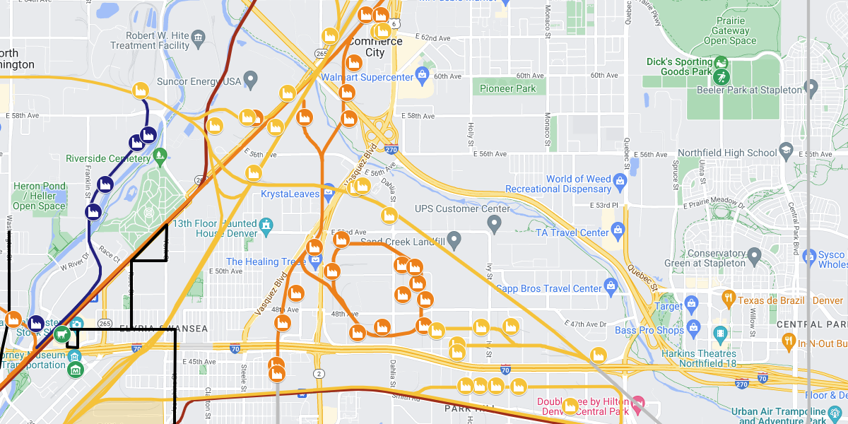
Key
Publicly Owned Track:
Red-Dark: Heavy Passenger Rail (state & local agency-owned)
Red-Light: Light Rail and Streetcar (state & local agency-owned)
Red-Faint: Standard Gauge Track (active and inactive freight) owned by state & local agencies
Class I Railroad Track:
Orange-Bright: Active Burlington Northern and Santa Fe Railroad (BNSF)
Orange-Faint: Inactive BNSF
Yellow-Bright: Active Union Pacific Railroad (UP)
Yellow-Faint: Inactive UP
Other:
Green: Landmark Tourist Attractions
Blue-Bright: Amtrak
Blue-Dark: Active Class II and III Railroads
Blue-Faint: Inactive Class II and III Railroads
Purple: Proposed, Planned, or Uncompleted Track
Grey: Abandoned Track – Standard Gauge
Brown-Dark: Preserved Tourist RR – Narrow Gauge
Brown-Light: Abandoned Track – Narrow Gauge
Black: Preserved Tourist RR – Standard Gauge
Black-Narrow: Former Urban Streetcar/Trolley Lines