GDT > Campaigns > RTD System Map
Please fill in our quick (less than 30 seconds) survey to support our campaign for RTD produce and periodically update a full system map.
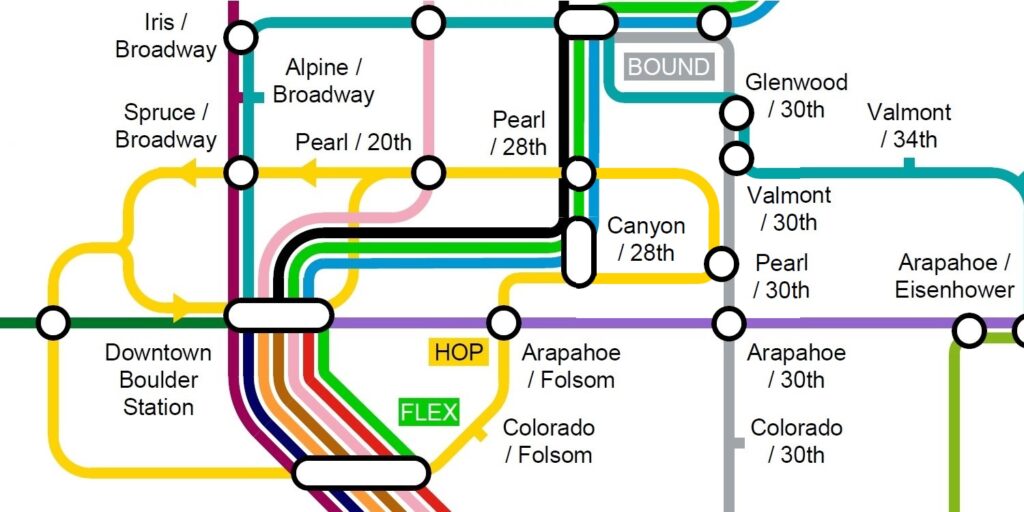
Full System Maps Are a Key Way of Communicating Transit Information

A good quality and up to date system map can be a n invaluable tool to help potential customers approach and learn about a transit system, up to a point of becoming confident users. Maps fill an information gap between trip planners and individual route / line information, neither of which really help enhance a customer’s understanding of how the overall transit system works.
A good example of this is New York City, where first time travelers are likely be a little overwhelmed the first time they see the Subway map, but will soon conclude that the system is so big and comprehensive that it is able to take them pretty much everywhere they need to go. This is naturally a very powerful marketing message for any public transit agency. Indeed some systems map (e.g. London Underground) have become cult design icons in their own right, up to a point where the transit agency sells merchandise featuring them.
Current, RTD’s approach is inconsistent with rail users being provided with a good-quality static map, but the same standard of information being deemed not necessary for bus users.
We request that RTD produces and periodically updates a full static system map.
As seen on #RTDSystemMap.
Frequently Stated Points
RTD Service Area Size
Several other transit agencies or groups of agencies that cover equivalent sized service areas to RTD such as Utah Transit Authority, Alameda-Contra Costa Transit District and St Louis’s Metro Transit produce a static system map for their customers. Areas of intense service such as Downtown Denver are usually handled by insets which clearly state that the scale has changed and that journey times across the inset section will be much shorter.
RTD Already Publishes an Online Map
The current online map relies on the user to have an internet-connected device to use as it can’t be displayed statically at stations and transit facilities. The experience is currently poor, with it being particularly hard to discern how the transit lines interact with each other, especially when viewed on a mobile device.
GIS Information Availability
The memo implies that any system map would be created by exporting map-based GIS data which is not the ask at all. The request is that any new system map is drawn up by a cartographer, in the same way the current rail map is.
Service Changes
While a system map would likely need to be updated three times a year, this is the same as the individual bus and rail line maps already have to be. The updates should take no more than a day of staff time for each service change.
Lack of Customer Requests
RTD’s recent claim that system maps are only appreciated and used by ‘transit enthusiasts’ shows a lack of understanding on how potential transit customers approach and learn about a transit system, up to a point of becoming confident users. The agency’s approach is currently inconsistent with rail users being provided with a good-quality static map, but the same standard of information being deemed not necessary for bus users.
Printing is not Sustainable
The goal of this campaign is for the system map to be published as a digital asset and displayed at stations and transit facilities. GDT does not feel that producing paper map leaflets for individuals to take away is necessary. It should be noted that a system map is intended to increase ridership by increasing awareness of the RTD system and making it easier to use, thus making it more likely customers will choose transit over less sustainable modes of transportation.
We need your help!
Please fill in our quick (less than 30 seconds) survey to support our campaign for RTD produce and periodically update a full system map.